I'm not a trained meteorologist but I am a licensed, instrument-rated pilot and also a licensed aircraft dispatcher. Training for both licenses includes a lot of weather-related information.
WARNING! METEOROLOGY CONTENT! WARNING!
Thunderstorm activity has three phases: developing, mature and dissipating.
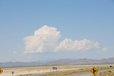
The developing phase is characterized by warm air near the ground being sucked up into a cloud mass. As the warm air rises it cools, releasing any water vapor into the cloud. As you watch a cloud in this phase you will see it billowing upward rapidly, almost boiling with activity.
The next phase is called mature, and it is characterized simply as the point at which water starts falling out of the bottom of the storm cell. The water droplets have been drawn up and down repeatedly inside the cloud, gaining more mass as they collide together, until eventually the rising air is unable to prevent them from dropping down to the ground.
The final phase is dissipation, when the bulk of the water vapor in the cloud is expended and the top forms a characteristic "blown anvil" look as the remaining water particles aren't dense enough to remain together and the cloud top blows apart.
Here are the first two pictures I took of the storm cell as I noticed it start to billow up:
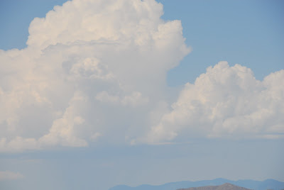
I noticed how uniformly flat the bottom of the cloud was... a possible sign of a temperature inversion. An inversion simply means warmer air above colder air; as a general rule, air gets cooler as the altitude increases. It was this warmer air that fed this cloud, I think. If you click the second picture you can see that there is water dropping out the bottom, so we're in the mature phase at this point.
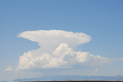
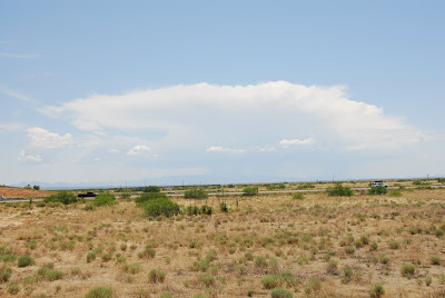
Here we can see an absolute textbook picture of the third stage, dissipating. In fact, this was better than the pictures in the textbooks I used during my training! As you can see, there is still rain dropping from the cloud even as it is starting to fall apart.
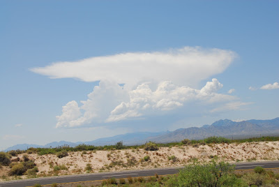
Further on down the road I stopped again (for those of you interested, my Nikon is way too heavy to use one handed so all pictures I take using it are when I am stopped) and you can see the top is really starting to blow over now.
Finally, all things must come to an end and this thunderstorm cell has burned out and is now blown apart:
In total I shot 99 photos of this cloud which you can see together here. I'm not yet skilled enough with my camera to maximize the contrast in the sky (the ground in some of these shots causes the camera to emphasize those colors too much, basically) but if you have any interest in this topic you may find them interesting.
END OF METEOROLOGY CONTENT